The Tug Barbara Lyn: A Tale of History and Salvage
The History of the Barbara Lyn
The Barbara Lyn, originally built in 1958 in Bayou La Batre, Alabama, began her life as the Sumter1. Over the years, she changed hands multiple times, serving various owners under different names. In 1989, she was acquired by the Ryba Marine Construction Company of Cheboygan, Michigan, and renamed the Barbara Lyn. This 52-foot tugboat, rated at 450 horsepower, was a single-screw vessel designed for towing.
In October 1990, the Barbara Lyn met her tragic end. While towing two construction barges to Alpena, Michigan, she capsized and sank 12 miles north of Huron City during a storm. The incident resulted in the loss of one crew member. The tugboat initially sank to a depth of about 200 feet.
The Salvage Attempt
Following the sinking, a salvage attempt was made to recover the Barbara Lyn. Salvagers managed to raise the tug from the deep waters, but another storm struck during the operation. The storm forced the salvagers to beach the tug in 20 feet of water just off Turnip Rock, near Port Austin. Unfortunately, the subsequent storm destroyed the pilot house and further damaged the vessel. Today, the Barbara Lyn rests in 20 feet of water, within visual distance of Turnip Rock.
Diving the Barbara Lyn
Diving on the Barbara Lyn offers a unique experience for divers. The wreck is relatively shallow, making it accessible to a wide range of divers. The site provides an opportunity to explore a piece of maritime history and witness the effects of the salvage attempt and subsequent storms on the vessel. The wreck’s location near Turnip Rock and the Port Austin Lighthouse adds to the allure of the dive, offering picturesque surroundings both above and below the water.
In summary, the Barbara Lyn’s story is one of resilience and tragedy. From her construction in Alabama to her final resting place in Lake Huron, the tugboat’s history and the efforts to salvage her remain a testament to the challenges and unpredictability of maritime operations.
Photogrammetry model of the Barbara Lyn as it sits on the bottom of Lake Huron.
An example of a typical Mackinaw design boat. (Photo Credit: Robert McGreevy)
Michigan
Divers, LLC announces the discovery of a previously unknown shipwreck, near the
Grindstone City Harbor. Captain Cindy Lynch, her husband
Captain Mike Lynch and Kevin Jimkoski were scuba diving from shore and
discovered the wreck site. It was initially believed that the wreckage
was from the Tug Margaretta, which exploded outside of the Grindstone Harbor in
1907. On a recent dive, Cindy, Chris Roth, and Kevin further explored the
site and it was determined that the wreckage was not from a tugboat but from a
small, single-masted sailing vessel. After consulting with local
historian and marine artist, Robert McGreevy, it was determined that the
wreckage was likely from a “Mackinaw Boat,” which was common for the area,
around the end of the 19th century. The small sailing vessel
was of “double-end design” and had at least one mast, a drop centerboard, and
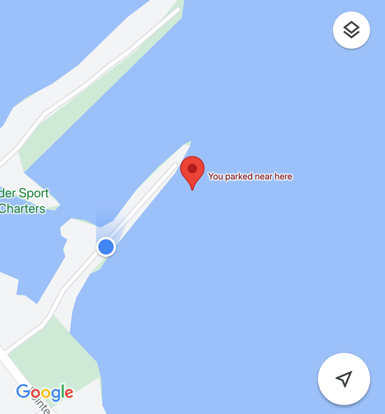
a tiller. The wreck site lies within the boundaries of the Thumb Bottom
Land Preserve and can be found in 8 ft of water, approximately 150’ due east of
the end of Grindstone City short point. People exploring the site can
expect to find many small artifacts and several different fish species.
This site should be an excellent local attraction for beginning divers, snorkelers,
and kayakers.
The Typical Mackinaw Boat Design in the 19th Century Great Lakes
Introduction
The Mackinaw boat, often referred to as the “pickup truck” of the 19th century, played a pivotal role in the maritime history of the Great Lakes. These versatile vessels were essential for explorers, traders, fishermen, and coastal residents, providing a reliable means of transportation and cargo hauling across the upper Great Lakes region.
Design and Construction
Mackinaw boats were known for their distinctive design, which combined elements from various maritime traditions. They typically featured a double-ended hull, round bilges, and a centerboard, making them highly maneuverable and seaworthy. The hulls were either carvel or lapstrake built, with the latter being more common. The boats were partially decked, providing some protection from the elements while maintaining an open workspace for fishing and cargo handling.
The construction materials for Mackinaw boats varied, but they were often built using locally sourced timber such as red or white oak. The boats ranged in length from 16 to 40 feet, with the larger models capable of carrying substantial loads. The design also included a plum stem, down-sprung bowsprit, and a raked sternpost, which contributed to their stability and performance in rough waters.
Rigging and Sails
Mackinaw boats were typically rigged with large sails, allowing them to take full advantage of the wind. The most common rigging was the gaff-rigged cat-ketch, which provided excellent balance and control. This rigging setup made the Mackinaw boat an efficient and fast vessel, capable of navigating the challenging conditions of the Great Lakes.
Usage and Significance
The versatility and reliability of Mackinaw boats made them indispensable for various maritime activities. They were widely used for commercial fishing, cargo transport, and passenger ferrying. Their ability to handle rough waters and beach safely in emergencies made them a preferred choice for many Great Lakes mariners.
Mackinaw boats were particularly significant in the commercial fishing industry, where they were used extensively throughout the 19th century. Their design allowed fishermen to venture offshore and work in isolation, knowing they had a dependable vessel to rely on.
Legacy
The legacy of the Mackinaw boat endures in the Great Lakes region, where they are celebrated for their historical importance and unique design. Many original Mackinaw boats have been preserved in museums, and modern replicas are often used for educational purposes and recreational sailing.
In conclusion, the Mackinaw boat’s design and functionality made it a cornerstone of 19th-century maritime life in the Great Lakes. Its enduring legacy is a testament to the ingenuity and craftsmanship of the boatbuilders who created these remarkable vessels.
Location of the Mackinaw design wreck site. Located just east (about 200-250ft) off the end of the short point at the Grindstone City marina.
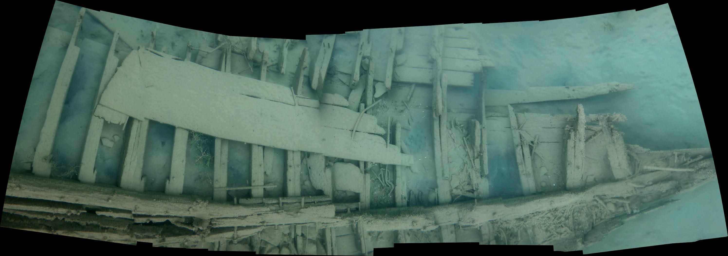
Photogrammetry model of the wreck site.
Divers Cindy Lynch and Kevin Jimkoski pose at the bow of the wreck site.
Remains of the bow. Notice the metal skeg on the keel.
Another view of the bow remains.
Remains of the stern.
Photomosaic of the keel showing the location of the drop centerboard.
The drop centerboard sits on the ribs at the port side near the bow.
JACOB BERTSCHY - 10 Feet Deep. The Jacob Bertschy was lost in a storm on September 3rd, 1879. It grounded with 51 crew and passengers (everyone was saved) and a cargo of shingles and wheat. The Bertschy was a wooden steamer built in 1867 in Sheboygan, WI, and was 138 feet long.
Drawing of the Jacob Bertschy by Artist Robert McGreevy (www.McGreevy.com)
Today the Bertschy sits in only 6-8 feet of water and is a possible shore dive (very long swim) out of Grindstone City Harbor or is reachable by boat for snorkeling or scuba diving.
News articles regarding the loss of the Jacob Bertschy
June 2021
There seems to be very little available or published in terms of a photo of the Jacob Bertschy or images of the wreckage. Capt'n Cindy decided it was time to change at least the lack of underwater images of the Jacob Bertschy wreck site. Initially, the wreck site of the Jacob Bertschy was listed as a shore dive from the Grindstone Marina. As we investigated the location of the wreck site, it was determined that it would be a long swim from shore to the reported location. Cindy rightfully opted to perform the search with her DiveX Pirahna DPV (Dive Propulsion Vehicle) or commonly called dive scooter.
Capt'n Cindy with her DiveX Pirahna DPV
Scootering out toward the believed wreck location, Cindy was able to find scattered remains of the vessel indicating she was headed in the right direction.
'
Scattered pieces of wreckage from the Jacob Bertschy
Continuing the search, additional pieces were found.
Additional wreckage scattered on the lake floor of the Jacob Bertschy
Finally, after additional searching of the area with the DVP, Cindy found the largest piece of the Jacob Bertschy wreckage, the keel. A photogrammetry model was created from the footage gathered to better understand how the wrecksite looks today.
Photogrammetry model of the wreck site of the Jacob Bertschy as it lies on the bottom of Lake Huron.
After many years on the bottom of Lake Huron, the wind, waves, and have broken up the wreck and scattered the debris across a large bottomland area. Much of the keel is now buried in the rock and gravel and the wreckage sits embedded and even with the bottom contours.
The Jacob Bertschy wreck site lies within theThumb Area Bottomland Preserve. As mentioned previously this is probably a site best enjoyed from a boat. The swim from shore is rather long!